
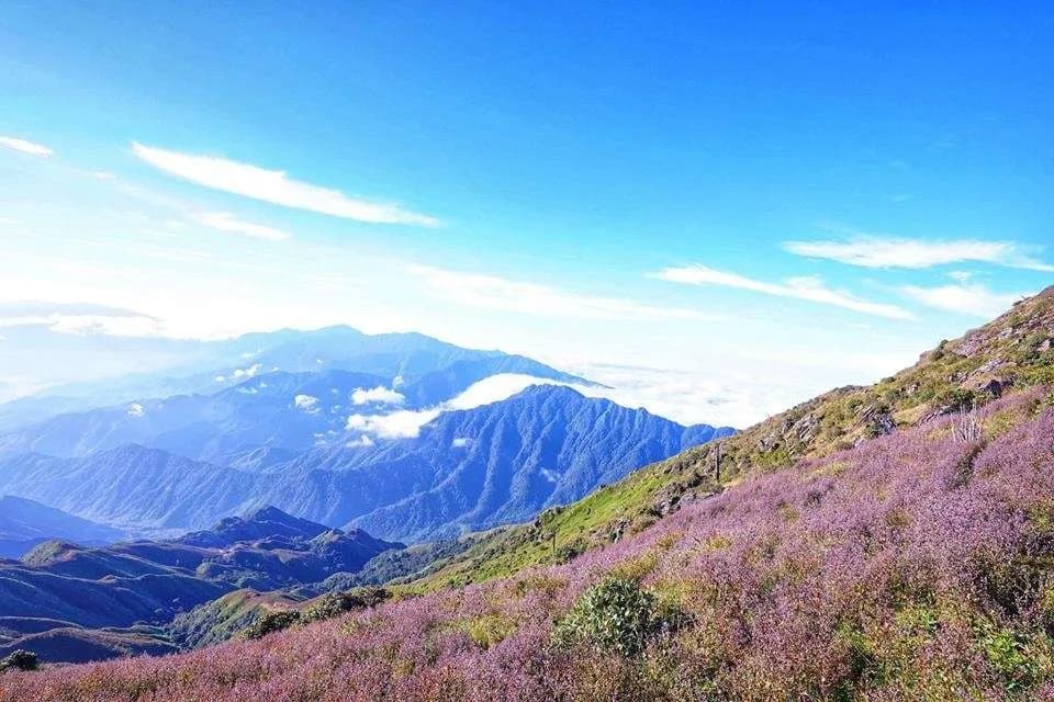

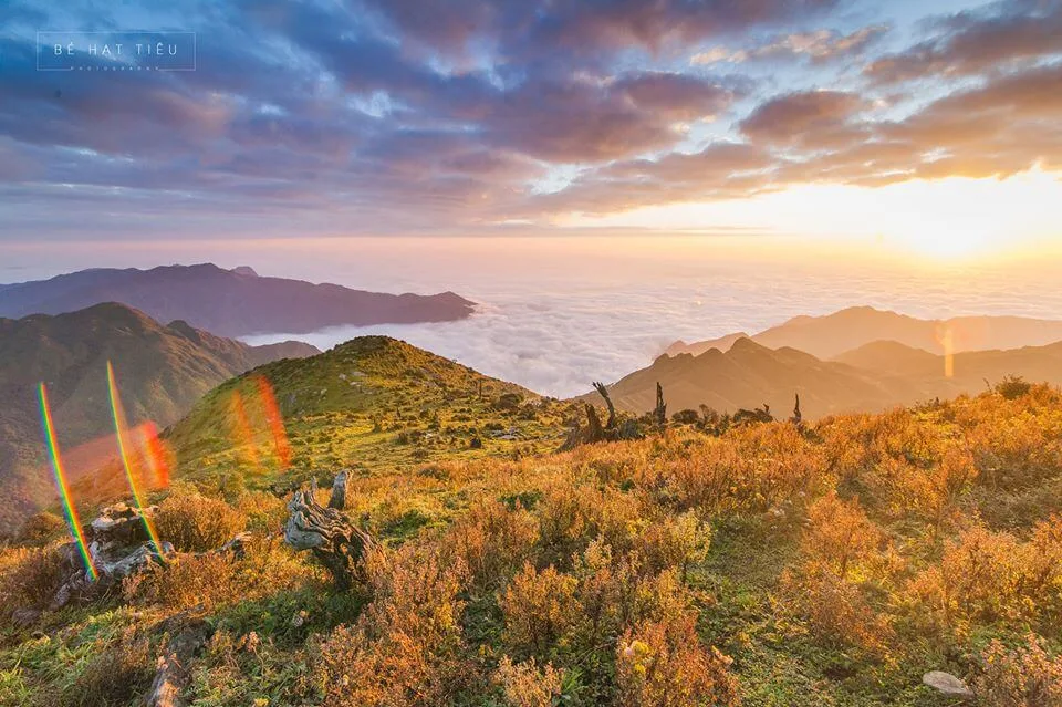
Open mountain slopes, clouds drifting across the hillsides, and purple Chi Pâu flowers make Ta Chi Nhu a popular destination for trekking enthusiasts. Behind those beautiful photos, however, is a long journey uphill and downhill that calls for stamina and careful preparation.
If you are planning a Ta Chi Nhu trek, start with three questions: Which route suits your abilities? Are the weather conditions suitable? And how has your group arranged the logistics? Let’s learn more about the Ta Chi Nhu trekking guide as we walk through each part to help you plan a realistic trip.
Discover more fascinating guides:
Ta Xua Travel Guide A-Z: Ultimate Tips for a 100% Successful Cloud Hunting Trip
Mekong Delta Floating Markets: Discover the Soul of Vietnam’s Waterways
1. An Overview of Ta Chi Nhu
1.1. Where Is Ta Chi Nhu, and How High Is It?
Ta Chi Nhu stands at 2,979 metres and is commonly described by trekking operators as Vietnam’s seventh-highest mountain. It lies along the boundary between the former Trạm Tấu and Mường La districts, with trekking routes approaching from Trạm Tấu and Nậm Nghiệp.
When researching directions, you may see “Xà Hồ, Trạm Tấu, Yên Bái” in older articles. Following the administrative changes in 2025, Xà Hồ Commune, Trạm Tấu Town, Bản Công, and Hát Lừu were merged into Hạnh Phúc Commune, Lào Cai Province. This guide uses the “Trạm Tấu approach” to help readers identify the traditional route, rather than as the current official administrative address.
On the other side of the mountain, Nậm Nghiệp Village belongs to Ngọc Chiến Commune, Sơn La Province—not Mù Cang Chải. Knowing the difference will help you book the correct transport, accommodation, and guide.
Ta Chi Nhu is also known as Phu Song Sung among the Thai ethnic community and Chung Chua Nhà among the Hmong.
1.2. How Difficult Is the Ta Chi Nhu Trek?
Ta Chi Nhu requires stamina, especially if you are not used to walking uphill for several hours. Operators use different difficulty ratings: Viettrekking classifies it as “advanced,” while Umove rates its Nậm Nghiệp–Trạm Tấu itinerary as “challenging—7/10.” These are each operator’s own ratings, rather than a universal standard.
Instead of relying only on a difficulty score, ask about the total distance, elevation gain, daily walking time, and backpack weight. On the traditional route, exposed hillsides, limited shade, and long uphill sections are important factors to consider.
If you have never trekked before, try a shorter route with both uphill and downhill sections before signing up. A practice hike will help you understand your walking pace, check your footwear, and see how well you recover after sustained activity.
2. When Is the Best Time to Trek Ta Chi Nhu?
2.1. September–October: Chi Pâu Flower Season
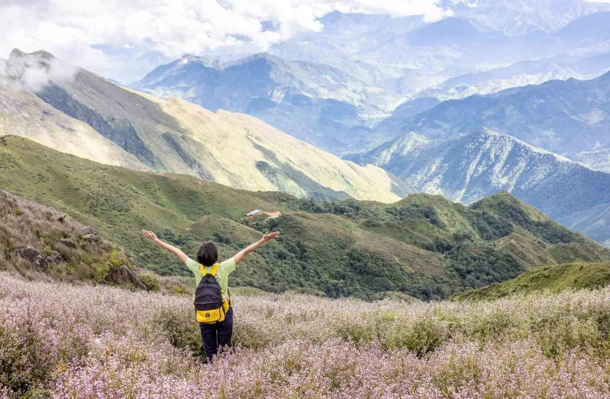
September and October are commonly recommended for seeing Chi Pâu flowers on Ta Chi Nhu. The purple flowers covering parts of the hillsides are a highlight of an autumn trek.
However, avoid booking a trip based only on photographs from the previous year. Before departure, ask your guide or operator about the current flowering conditions and request recent photos with clear dates.
Chi Pâu is a name commonly used in travel writing. Vietnam’s tourism information website describes the flowers as belonging to the genus Swertia. This guide does not identify them as a particular species referred to as “long đởm” without sufficiently clear botanical evidence.
2.2. November–March: A Popular Time for Sea-of-Clouds Views
November through March is often recommended for cloud-viewing treks, when northern Vietnam generally experiences colder conditions and less rainfall than in summer. High on the mountain, however, you may still encounter bitter cold, fog, and strong winds.
A sea of clouds is a natural phenomenon with no fixed schedule. When choosing your dates, prioritise suitable walking conditions and a reliable return plan rather than expecting guaranteed cloud views.
If you take the Nậm Nghiệp approach around March, you may also be able to see sơn tra, or local hawthorn blossoms. Sơn La Newspaper has reported forests of white-flowering sơn tra trees in the village during this period.
2.3. May–August: Think Carefully About the Rainy Season
May through August generally overlaps with northern Vietnam’s rainy season, which can bring less favourable conditions for climbing Ta Chi Nhu.
A seasonal recommendation is not an automatic green light. Even an autumn trip should be postponed if dangerous weather is forecast. Check the forecast for the mountain area, speak with people currently operating the route, and agree on cancellation or rescheduling terms before paying.
3. Comparing the Trạm Tấu and Nậm Nghiệp Approaches
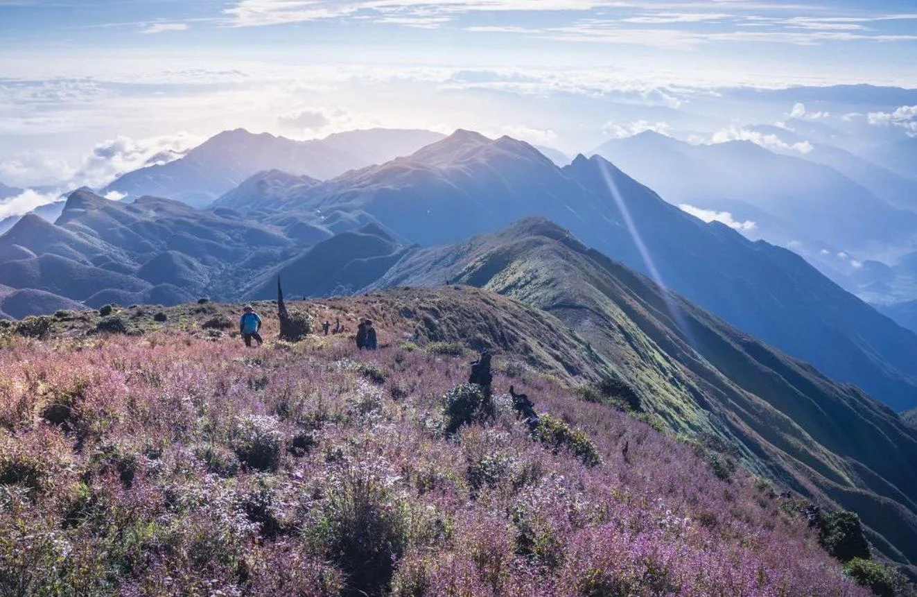
The two approaches differ in their starting points, scenery, and logistics. In particular, some tours start in Nậm Nghiệp and descend towards Trạm Tấu. A route name does not necessarily mean you will return the same way you came.
Category | Trạm Tấu Approach—Mỏ Chì Area | Nậm Nghiệp Approach |
Access area | The former Xà Hồ area, now part of Hạnh Phúc Commune, Lào Cai Province | Ngọc Chiến Commune, Sơn La Province |
Main features | The traditional route, with open hillsides and long uphill sections | Access from Nậm Nghiệp, with opportunities to enjoy the sơn tra landscape |
Indicative distance | Approximately 16–18 km for the full trek, depending on the starting point and actual route | Confirm with your specific itinerary; do not assume it is 12–14 km |
Ascent and descent | You may ascend and descend on the Trạm Tấu side | Some itineraries ascend from Nậm Nghiệp and descend towards Trạm Tấu |
What to confirm beforehand | Starting point, mountain shelter location, total elevation gain, and transfers | Finishing point, luggage transfers, pickup arrangements, and expected descent time |
When booking, ask the organiser for a route map or GPS track, the shelter location, and the descent plan. These details are more useful than a general claim that the trek is suitable for everyone.
4. A 2-Day, 1-Night Ta Chi Nhu Trekking Itinerary via Trạm Tấu
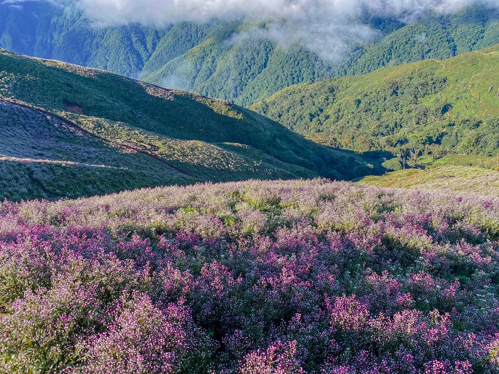
“Two days and one night” usually refers to the walking portion and the overnight stay on the mountain. If you are leaving from Hanoi, allow additional travel time from the afternoon or evening before the trek.
The schedule below is a suggested framework based on operators’ published itineraries, with room for delays. Confirm the actual timings with your trip leader and guide.
Night 0: Hanoi to the Trạm Tấu Area
Leave Hanoi in the afternoon or evening and travel to your accommodation for a rest before the trek. Confirm your pickup and drop-off locations, dinner arrangements, and check-in time in advance.
If you are booking your own bus, check whether it goes directly to the Trạm Tấu area or requires a connecting journey. Do not assume that a 10:00 p.m. departure will work for every trekking schedule.
Day 1: Trạm Tấu—Trekking Start Point—Mountain Shelter
Approximate time | Activity |
5:30–7:00 a.m. | Have breakfast, leave behind luggage you will not need on the mountain, attend the route briefing, and check your equipment. |
7:00–8:00 a.m. | Transfer to the starting point, warm up, and distribute the group’s shared supplies. |
Morning | Begin trekking at the group’s pace, taking short breaks in suitable places. |
Around midday | Have lunch, check remaining water supplies, and assess how each group member is feeling. |
Afternoon | Continue towards the shelter, adjusting the pace to the group’s fitness and weather conditions. |
Late afternoon–evening | Settle into your sleeping space, change into dry clothes, have dinner, and rest early for the next day. |
Timings may change depending on the starting point, the group’s pace, and conditions on the day.
Keep a steady pace from the beginning. Trying to stay with faster walkers can leave you exhausted later in the day. If the group splits into different pace groups, the leader should assign someone to supervise each one and agree on meeting points.
Once you reach the shelter, keep your sleeping clothes dry and prepare your headlamp, warm layers, water, and snacks for the following morning. Avoid leaving everything until it is time to depart.
Day 2: Mountain Shelter—Ta Chi Nhu Summit—Descent
Approximate time | Activity |
Around 4:30–5:30 a.m. | Have breakfast, check the weather, and prepare the equipment you need for the summit. |
Early morning | Begin the summit ascent if the trip leader considers conditions suitable. |
After visiting the summit | Return to the shelter, pack your belongings, and collect all your personal rubbish. |
Late morning–afternoon | Descend, with rest and lunch stops arranged by the group. |
Afternoon–evening | Return to your accommodation, freshen up, and travel back to Hanoi. |
Timings may change depending on the group’s fitness, the weather, and trail conditions.
Reaching the summit early in the morning does not guarantee that you will see the sunrise. If this is a main goal, check the sunrise time and calculate the walking time from your group’s actual shelter.
A hot mineral spring visit may be an optional activity after the descent if there is enough time. Leave a buffer before your return journey rather than booking transport too close to your expected arrival at the trailhead.
5. What to Pack for a Ta Chi Nhu Trek

5.1. Footwear and Clothing
Choose footwear suited to the terrain, with soles in good condition, and wear it on practice walks before the trip. Your shoes should hold your feet securely while leaving enough room for your toes. Try them on with the socks you plan to wear. There is no universal rule that everyone needs to go up exactly one shoe size.
Bring clothing that is easy to adjust as conditions change: a layer for walking, an insulating layer, and an outer layer that protects against rain and wind. Pack your sleeping clothes and spare socks separately in a waterproof bag.
Before leaving, ask what blankets, sleeping mats, or sleeping bags the shelter provides, then compare this with the temperature forecast. Do not assume that the supplied bedding will be adequate for every cold spell.
5.2. Essential Personal Equipment
Your basic packing list should include:
A headlamp with spare batteries or a backup power source.
A phone with downloaded maps, a power bank, and a charging cable.
Water bottles or a hydration bladder, plus extra snacks.
A first-aid kit, blister-care supplies, and personal medication.
A hat, sunglasses, and sunscreen.
Rain protection, warm clothing, and waterproof storage for dry items.
A whistle and suitable emergency shelter equipment for the group’s plan.
Prepare for the possibility of spending longer outdoors than expected.
Trekking poles are worth considering for a route with plenty of climbing and descending. If your operator lends them, check the locking mechanisms and practise using them before the trek.
5.3. Drinking Water and Logistics
Go beyond asking, “Does the tour provide water?” Confirm how much water is supplied, who carries it, where you can replenish it, and how drinking water is made safe.
Similarly, clarify whether porters are responsible for guiding, carrying shared supplies, or carrying additional personal belongings. Agree on luggage limits beforehand so you do not arrive at the trailhead and discover that you need to carry more than expected.
Keep personal medication somewhere easy to reach. If you have an existing medical condition, allergies, or ongoing treatment, discuss the trip’s suitability with your doctor and share relevant information with the person responsible for supporting the group.
6. Budgeting for a Ta Chi Nhu Trek
An independently organised trek with a guide means you book the services yourself and coordinate the logistics. Your total cost depends on the group size, number of porters, route, and services arranged.
Use the following checklist to build your budget:
Expense | What to confirm |
Transport from Hanoi to your accommodation and back | Request a quote for your travel dates, vehicle type, and pickup and drop-off locations. |
Transfers to the trailhead | Confirm the number of journeys, vehicle type, and luggage allowance. |
Guides and porters | Agree on the number of support staff, number of days, responsibilities, and carrying limits. |
Food and water on the mountain | Confirm the number of meals, drinking water supplied, and any dietary requirements. |
Mountain shelter and accommodation before the trek | Check whether prices are per person or per group, and what equipment is provided. |
Insurance, equipment rental, and extra services | Check each item’s cost and the conditions that apply. |
Contingency budget | Allow for transport changes, an extra night’s stay, or itinerary adjustments. |
A simple budgeting formula is:
Cost per person = individual expenses + (total shared expenses ÷ number of participants) + contingency allowance.
Without comparable quotes for the same dates, it would be misleading to say that an independently organised trip will definitely cost only VND 1.8–2.2 million per person. Smaller groups may need to split transport and logistics costs among fewer people, while larger groups still need sufficient support staff.
If this is your first trek, consider the group’s operational arrangements alongside the price. Who supports slower walkers? When will the group turn back? And who arranges the descent if someone needs assistance?
7. Practical Tips for a Better-Prepared Ta Chi Nhu Trek
7.1. Prepare According to Your Current Fitness
One or two weeks of training does not guarantee that everyone will complete the trek. If you are not regularly active, give yourself time to build stamina before committing to the trip.
Speak with the organiser about a preparation plan that includes gradually increasing your walking, practising uphill and downhill sections, and getting used to your backpack. A practice hike should help you identify what you need to work on, rather than push you to match someone else’s numbers.
Before departure, be honest about your health. A confirmed booking is not a reason to continue with the trip if your body is not ready.
7.2. Recognise Symptoms of Altitude Illness
According to the CDC, people who are not acclimatised can develop altitude illness at elevations of around 2,450 metres or higher. Good fitness does not remove this risk.
If you develop a headache accompanied by nausea, dizziness, or unusual fatigue, tell your trip leader immediately. Do not continue ascending to sleep at a higher elevation while experiencing symptoms. If your condition worsens despite resting, you need to descend to a lower elevation. Breathlessness at rest, confusion, or loss of coordination requires urgent attention.
Do not hide symptoms just to reach the summit. Likewise, do not take medication simply to keep climbing without an appropriate assessment.
7.3. Agree on How the Group Will Stay Together
Before setting out, know who leads the group, who stays at the back, where the meeting points are, and how to signal that you need to stop. Do not leave the group to take photos or follow another trail without telling the person in charge.
Share your itinerary and the organiser’s contact details with someone at home. The group should also agree on a turnaround time and a plan for a delayed descent.
7.4. Prepare Your Maps Before Losing Connectivity
The Explorer plan on ExoTrails includes offline maps, off-route alerts, Back to Start, and TrackMate. Explore these features before your trip to decide which tools suit your needs.
Before departure, check that your maps are downloaded, location permissions are enabled, your battery is charged, and you understand how to use the features. TrackMate requires an internet connection and appropriate location permissions to update live positions. The group must still carry out headcounts, maintain communication, and have its own support plan.
Maps and tracking features are supporting tools. They do not replace a guide or the group’s assessment of actual conditions.
7.5. Protect the Landscape
Follow the recommended route, avoid stepping on flower-covered areas, do not pick plants, and carry your rubbish down the mountain.
When taking photos, choose a stable place to stand and avoid obstructing other groups. If you need to use a stove or fire, follow the organiser’s instructions and local regulations.
8. Frequently Asked Questions
8.1. Can Someone Who Has Never Climbed a Mountain Trek Ta Chi Nhu?
It may be an option after an assessment of your fitness and advice on a suitable route. Beginners should try a shorter hike with uphill and downhill sections first. Two weeks of training or choosing the Nậm Nghiệp approach should not be treated as enough on their own to ensure completion.
8.2. How Long Does the Ta Chi Nhu Trek Take?
Many itineraries include two days of trekking and one night on the mountain. Allow additional time for travelling from your starting location, staying overnight before the trek, and returning afterwards.
8.3. Do the Mountain Shelters Have Toilets, Washing Facilities, and Bedding?
Facilities vary between shelters. Ask about the specific shelter your group has booked, including toilets, water for washing, bedding, capacity, and charging facilities. Information about one shelter should not be assumed to apply to the entire route.
8.4. Is There Mobile Reception on Ta Chi Nhu?
This guide does not have current coverage measurements to confirm which network is reliable at the shelters or summit. Prepare for the possibility of losing connectivity, download your maps beforehand, and agree on a communication plan.
8.5. Should You Trek Ta Chi Nhu in One Day?
If you are not used to mountain hiking, choose an itinerary with time for rest and unexpected delays. A one-day trek needs to be assessed by the organiser based on your fitness, route, weather conditions, and available descent time. Avoid shortening the trip simply to save on an overnight stay.
8.6. Does Visiting During Chi Pâu Season Guarantee You Will See Flowers?
No. September and October are seasonal guidelines. Confirm flowering conditions close to your departure date through your guide and recent photographs.
Get Ready for Ta Chi Nhu with ExoTrails
A memorable trek starts with choices that suit you: a clear route, confirmed logistics, and enough stamina to enjoy the journey. Take time to prepare so that every step up the mountain is part of an adventure you feel ready for.
Before your trip, explore offline maps and outdoor tools on ExoTrails.
Please note: This information was checked against public sources on October 8, 2026. Access routes, weather, services, and prices may change. Confirm the details with your operator or guide before departure. ExoTrails provides information and tools to support your trip; participants and organisers must assess conditions, maintain communication plans, and take responsibility for their decisions in the field.
Join the community and keep up with the latest from ExoTrails:
👥 Join our Facebook group: Run, Trek & Camp | Basecamp Việt Nam — Share mushroom-foraging locations, read trail reviews, and connect with fellow outdoor enthusiasts.
👍 Follow our Facebook page: ExoTrails — Get the latest forest safety tips, weather updates, and special offers!