
Looking for mountains near Ho Chi Minh City where you can walk through greenery, spend time outdoors or enjoy views beyond the busy streets?
Chau Thoi offers a shorter temple outing, while Dinh Mountain has forest routes to research. Thi Vai combines uphill walking with pagoda visits, and Chua Chan and Ba Den require more careful planning if you intend to hike. Around Vung Tau, coastal hills offer another way to add walking to a weekend away.
The key is choosing the right route. Walking up temple steps, following a forest trail and visiting a summit by cable car are different experiences, even when they take place on the same mountain.
This guide compares eight destinations and explains what to check before you go.
Information reviewed on November 19, 2026. Distances are approximate figures from published destination guides, rather than live route measurements from your accommodation. Confirm access, operating hours and local restrictions before travelling.
What Does “Near Ho Chi Minh City” Mean?
Following Vietnam’s 2025 administrative reorganisation, Ho Chi Minh City includes the former provinces of Binh Duong and Ba Ria–Vung Tau. Some mountains previously described as being outside the city now fall within its expanded boundaries.
For practical trip planning, this article uses central Saigon as the general starting area. Familiar regional names such as Di An, Phu My, Ba Ria and Vung Tau are retained to help you recognise destinations in maps and older travel guides.
Mountains Near Ho Chi Minh City: A Quick Comparison
Mountain | General location | Approximate distance from central Saigon | Experience to research |
Chau Thoi Mountain | Di An area | Around 30 km | Temple visit and stair walking |
Thi Vai Mountain | Phu My area | Around 65 km | Stone steps and mountainside pagodas |
Dinh Mountain | Phu My–Ba Ria area | Around 80 km | Forest hiking on a specific planned route |
Chua Chan Mountain | Xuan Loc, Dong Nai | Around 100–110 km | Hiking or a pagoda visit using the cable car |
Minh Dam Mountain | Long Hai–Phuoc Hai area | Around 110 km | Walking and historical-site visits |
Big Mountain — Nui Lon | Vung Tau | Around 110 km | Coastal views and walking on permitted routes |
Small Mountain — Nui Nho | Vung Tau | Around 110 km | Uphill walking and individual attractions |
Ba Den Mountain | Tay Ninh | Around 120 km | Cable-car sightseeing or regulated hiking |
Published distances depend on the starting point, road route and entrance used. Check the complete journey before booking transport.
Choose by route, rather than mountain height alone. Distance, cumulative ascent, terrain, heat and the return journey all affect how demanding your day will be.
1. Chau Thoi Mountain: A Shorter Walk with a Temple Visit
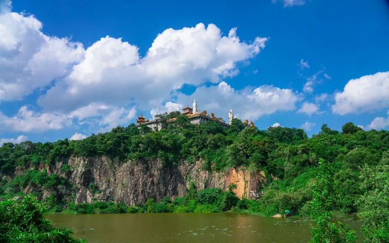
What is Chau Thoi like?
Chau Thoi Mountain is in the Di An area and is closely associated with Chau Thoi Pagoda. Local reporting, citing museum information, places the hill at approximately 82 metres above sea level and describes a pedestrian approach with 220 steps.
Consider it if you want a shorter outing combining walking and a religious site, rather than a full forest hike.
Who should consider visiting?
Chau Thoi can be a starting point for travellers who want to try uphill walking without committing to a longer mountain itinerary.
However, stairs still require balance and leg strength, especially on the descent. If someone in your group has limited mobility, ask about the available approaches and conditions before travelling.
Planning tips
Search for “Chùa núi Châu Thới” and confirm the pedestrian entrance.
Dress respectfully, keep noise low around worship areas and follow any restrictions. Avoid rock edges and assume neither picnicking nor camping is permitted without confirmation.
2. Thi Vai Mountain: Stair Walking and Mountainside Pagodas
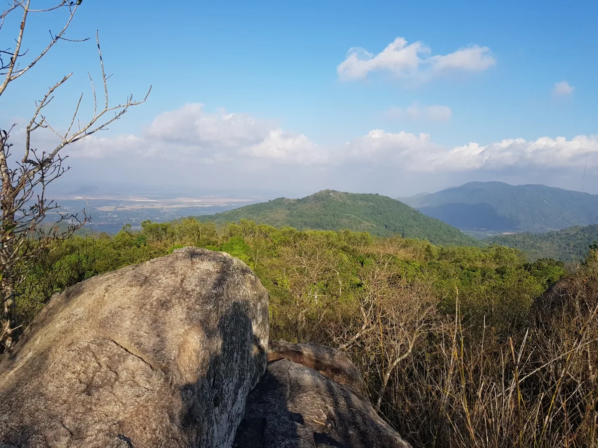
What makes Thi Vai different?
Thi Vai Mountain is in the Phu My area. The Ba Ria–Vung Tau Museum describes it as approximately 470 metres high. The mountain is associated with Buddhist sites, including Linh Son Buu Thien Pagoda.
Published accounts describe a stone-step pilgrimage route. Visiting the pagodas and continuing onto other mountain paths should be treated as separate activities with different access requirements.
Is it suitable for beginners?
Consider the established pagoda approach if you are comfortable with sustained stair climbing and want to combine walking with cultural sightseeing.
Steps can make a route easier to recognise, but they do not make it effortless. Set a comfortable pace, allow breaks and keep enough energy for the descent.
Before you go
From central Saigon, the broad travel direction is towards Phu My. Confirm the final approach rather than following an old junction-by-junction blog itinerary.
Ask about:
The current entrance and parking location.
The steps used by visitors.
Areas open for sightseeing.
Visiting hours and conditions after rain.
Do not extend your walk onto unfamiliar forest paths without establishing that access is permitted.
3. Dinh Mountain: Choose a Specific Forest Route
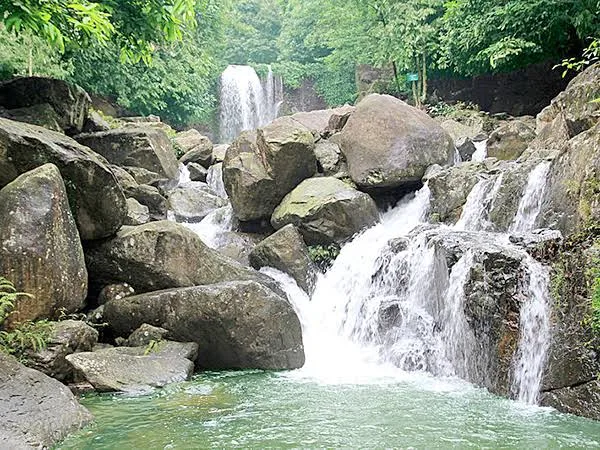
Why consider Dinh Mountain?
Dinh Mountain lies near the National Highway 51 corridor in the Phu My–Ba Ria area. Published sources describe a mountain area rising to around 500 metres, with forest scenery, pagodas and historical sites.
It is particularly important to choose a route before travelling. ExoTrails lists several Dinh Mountain itineraries, including routes named 5 km, 7 km and 11 km. “Hiking Dinh Mountain” therefore does not describe one fixed activity.
How should you choose a route?
Before deciding, review:
Total distance and cumulative ascent.
Start and finish locations.
Whether the route is a loop or an out-and-back.
Steep, rocky or navigationally confusing sections.
Options for shortening the walk.
You can begin your research with the Dinh Mountain Green Plus Route on ExoTrails. Assess its details against your own experience and confirm current access locally.
Do you need a guide?
If you are unfamiliar with the trail network, consider joining someone who knows the selected route or booking an appropriate guided outing.
Avoid changing trails simply because another path looks well used. Likewise, do not assume natural streams along a route are approved swimming areas or sources of drinking water.
4. Chua Chan Mountain: Plan Both the Ascent and Descent
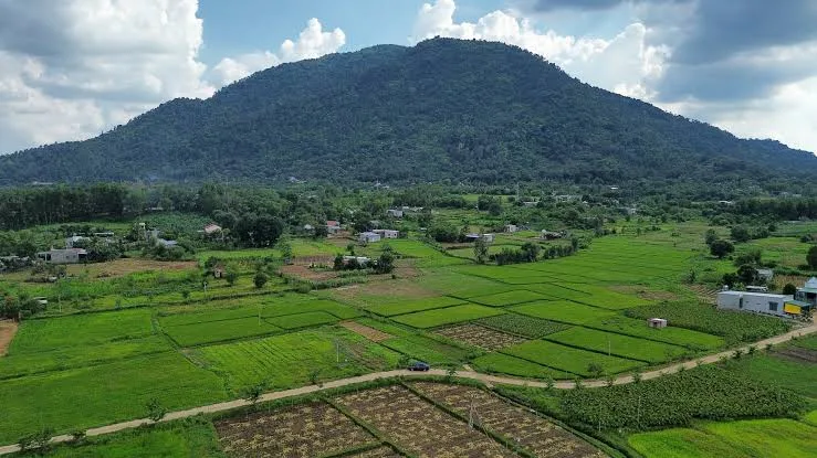
Where is Chua Chan Mountain?
Chua Chan Mountain is in the Xuan Loc area of Dong Nai. It reaches 837 metres, and a public environmental-assessment document places it approximately 100–110 km from Ho Chi Minh City via National Highway 1.
The destination includes Buu Quang Pagoda and a cable-car service associated with pagoda visits. Taking the cable car to the religious area should not be confused with completing a summit hike.
Decide what your visit includes
Agree on the itinerary before leaving:
Are you visiting the pagoda or planning a hike?
Where does your chosen route finish?
How will you return?
What happens if someone cannot continue?
Do not improvise a combination of walking and cable-car travel without confirming the connection points, operating hours and permitted paths.
Can you camp on Chua Chan?
Confirm permission, the location and applicable rules before arranging an overnight stay.
Local reporting in 2026 highlights active forest management and fire-prevention work around Chua Chan. Photographs of previous camping trips do not establish that camping or cooking is currently permitted at a particular spot.
5. Minh Dam Mountain: Walking with Historical Context
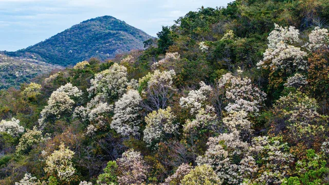
What can you explore?
Minh Dam is in the Long Hai–Phuoc Hai area. Its historical sites are associated with wartime resistance bases, rock shelters and memorial spaces. Vietnam’s national tourism authority presents it as a destination combining historical significance with forest and coastal scenery.
Consider it if you want an outdoor outing that also introduces local history.
A site visit and a hike are different itineraries
Driving to the historical area and walking between visitor sites involves a different amount of activity from beginning a longer route lower on the mountain.
Ask for the exact starting point, walking distance and terrain before deciding how physically demanding the trip will be.
Visiting responsibly
Follow the open visitor paths. Ask staff before approaching caves, rock shelters or sites outside the main route.
If combining the trip with a stay around Long Hai or Phuoc Hai, leave time to rest instead of adding too many stops to the same day.
6. Big Mountain — Nui Lon: Coastal Views around Vung Tau
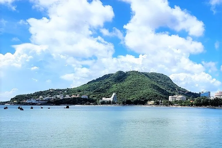
What kind of outing can you plan?
Big Mountain offers several distinct ways to explore the Vung Tau area. Bach Dinh, also known as the White Palace, is on its slopes, while Ho May is a tourism complex on the mountain with cable-car access.
Choose whether you want a walk, a historical-site visit or a ticketed attraction. These options have different entrances, schedules and costs.
Walking considerations
Check that your chosen route is open to pedestrians and whether it is shared with vehicles.
On shared roads, be particularly attentive at bends and avoid stopping in the carriageway for photographs. Do not cross private land, restricted areas or attraction boundaries to connect separate paths.
If planning a sunset walk, allow enough time for the return journey. Reaching a viewpoint is only part of the outing.
7. Small Mountain — Nui Nho: Add an Uphill Walk to a Beach Weekend
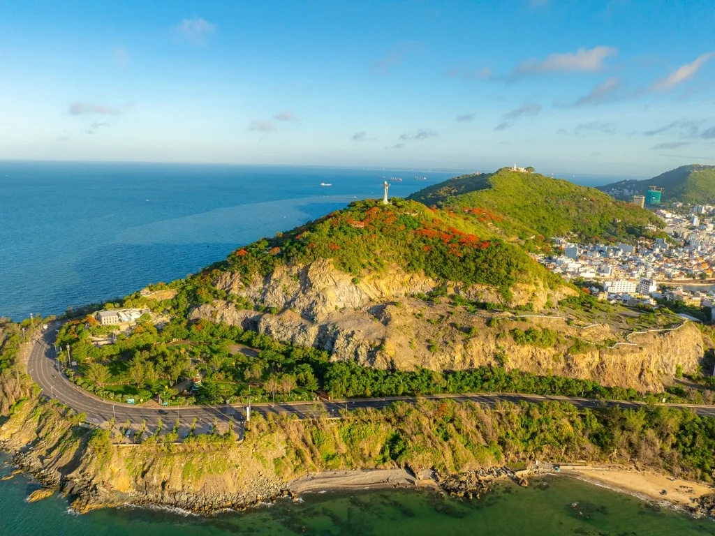
What is Small Mountain known for?
Small Mountain is associated with familiar Vung Tau attractions, including the lighthouse and Christ statue. Vietnam’s tourism database identifies the Christ statue as being on Nui Nho.
It is worth considering if you want to add walking to a coastal trip.
Choose one clear destination
The lighthouse approach and the Christ statue visit are separate outings. Do not assume a public walking trail connects them across the mountain.
Pick your destination, check its visiting arrangements and confirm any dress requirements. An attraction may have different access hours from the road leading towards it.
Is it beginner-friendly?
Choose a walking distance that suits your ability, taking gradients, sun exposure and the return journey into account.
Wear appropriate footwear and avoid adding extra uphill sections simply because they appear close on a map.
8. Ba Den Mountain: Cable-Car Sightseeing or Regulated Hiking
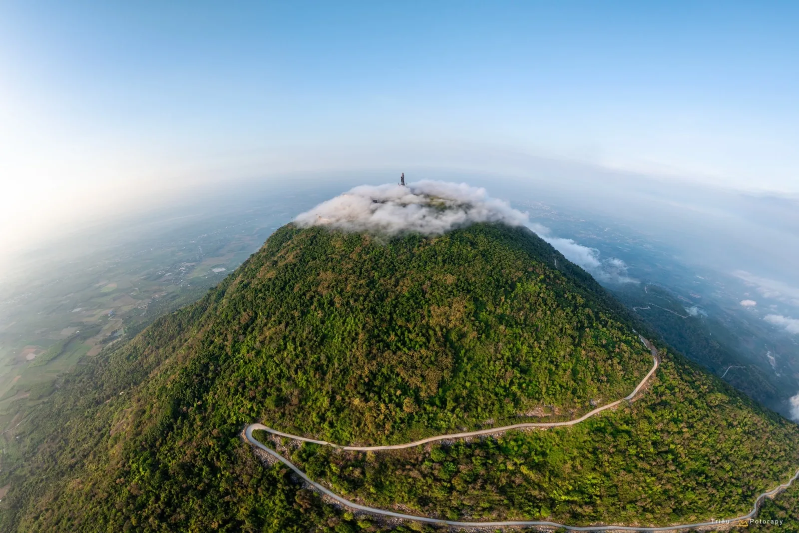
How high is Ba Den Mountain?
Ba Den Mountain in Tay Ninh reaches 986 metres. The operator’s Van Son cable-car route connects the mountain’s base with its summit area.
A cable-car visit and a walking ascent require different preparation. Decide which experience you want before booking transport or tickets.
Check the hiking rules
January 2026 reporting, citing the destination’s management board, identifies authorised walking routes, mandatory registration at the management checkpoint and a departure window beginning at 5 a.m., with no starts after 11 a.m.
Before travelling, confirm the precise route, registration point and current requirements with the management board. Do not rely on an older blog’s list of routes as evidence that all remain open.
What about Ma Thien Lanh?
Do not plan an independent approach based only on travel videos or informal recommendations.
April 2026 reporting documented a checkpoint controlling entry into the Ba Den cultural and historical forest through the Ma Thien Lanh approach. Visitors must follow the relevant access requirements.
If you prefer a cable-car visit
Check the official Sun World Ba Den Mountain website for ticket options and operating information. Confirm which destinations a ticket covers and the last return service.
Which Mountain Should Beginners Choose?
Start with the kind of activity you want to do.
Your priority | Options to research | What to check |
A shorter walk with a temple visit | Chau Thoi | Steps, visiting arrangements and mobility needs |
Sustained stair walking | Thi Vai’s established pagoda approach | Gradients, stopping points and surface conditions |
A first forest hike | A specific Dinh Mountain route | Distance, ascent, navigation and guidance |
Walking with local history | Minh Dam | Visitor areas and the actual walking itinerary |
A walk during a coastal weekend | Big Mountain or Small Mountain | Permitted paths and attraction hours |
A more demanding walking objective | Chua Chan or an authorised Ba Den route | Fitness, registration and descent arrangements |
Mountain sightseeing with less climbing | Appropriate cable-car services | Where the service ends and how much walking remains |
This is a planning comparison, rather than a universal difficulty rating. A short route can still be demanding in heat or on steep terrain.
How to Prepare for Hiking Near Ho Chi Minh City
Plan the return, not just the summit
Choose a turnaround time before setting out. Allow for rests, slower walking and the journey home.
The US National Park Service recommends setting and following a turnaround time to avoid being caught out after dark.
Check weather and access separately
A favourable forecast does not confirm that a route is open.
Check weather information through Vietnam’s National Center for Hydro-Meteorological Forecasting, then confirm local restrictions with the relevant manager or operator.
If thunderstorms are forecast, change the plan. NPS lightning guidance emphasises planning outdoor activities around the weather and seeking appropriate shelter when storms develop.
Pack for the actual route
Consider bringing:
Footwear with grip appropriate to the terrain.
Drinking water and food for the expected activity.
Sun protection and rainwear.
Personal medication and first-aid supplies you know how to use.
A charged phone, power bank and headlamp.
Prepared maps and route information.
A bag for carrying out rubbish.
Do not depend on unconfirmed food stalls or water stops.
Prepare navigation before losing reception
Research your route and download any required maps before leaving.
ExoTrails offers offline maps within the app to support outdoor navigation. Use them alongside current signs, local instructions and confirmed access arrangements.
Arrange transport home
Agree on pickup locations and return arrangements before leaving central Saigon. Do not assume an on-demand vehicle will be available at a trailhead.
Choose transport that matches your experience and check any licensing and insurance requirements if you intend to ride a motorbike.
Tickets, Parking and Camping: What Should You Confirm?
There is no single cost for visiting mountains near Ho Chi Minh City. Independent walks, historical sites, guided hikes and cable-car attractions have different arrangements.
Item | Questions to ask |
Admission | Which area or activity does the ticket cover? |
Parking | What is the charge, and when must you collect the vehicle? |
Guided hikes | Which route, equipment and insurance are included? |
Cable cars | Is the ticket one-way or return, and when is the last service? |
Camping | Is it permitted, where, and with whose approval? |
Weather changes | What happens if access or activities are suspended? |
The absence of a ticket booth does not establish permission to enter forest land, camp or light a fire.
Frequently Asked Questions
What are the closest mountains to central Ho Chi Minh City?
Among the destinations in this guide, Chau Thoi is the closest based on commonly published distances. Thi Vai and Dinh Mountain are other options to compare for a trip from central Saigon.
Can you visit these mountains in one day?
Several can fit a day trip, depending on your route and transport. Include the full travel time, ascent, descent and breaks when deciding.
Does a lower mountain mean an easier hike?
No. Summit elevation is different from the amount of climbing on your route. Terrain, distance, weather and your fitness also affect difficulty.
Should first-time visitors hike alone?
For an unfamiliar forest route, consider a knowledgeable companion or suitable guide. Share your itinerary and expected return time with someone who is not joining you.
Can you hike Ba Den using any route?
No. Walking access is regulated. Confirm the permitted route, registration requirements and departure rules before travelling.
Does the Chua Chan cable car take you to the summit?
Do not assume so. Check the service’s destination and any additional walking required for your intended visit.
Find a Route That Fits Your Weekend
The mountains near Ho Chi Minh City offer different ways to spend time outdoors, from a temple staircase to a planned forest hike or a cable-car visit.
Choose a manageable route, confirm access and leave enough energy for the return. You can explore routes with ExoTrails as you plan your next outing.
For ideas farther afield, read our guide to the best hikes in Vietnam.
Connect with our outdoor community and stay updated:
👥 Join our Facebook Group: Run, Trek & Camp | Basecamp Việt Nam – Share your foraging spots, trail reviews, and connect with fellow adventurers!
👍 Like our Facebook Page: ExoTrails Worldwide – Get real-time trail updates, forest safety tips, and exclusive offers.