
Table of Contents Show
If you’ve loved ExoTrails for its ability to navigate routes, record adventures, and share outdoor experiences through TrackMate, the new ExoTrails 2.2.0 is the leap forward you’ve been waiting for.
This update doesn’t just make things smoother and more accurate. It brings a smarter, more intuitive mapping and navigation experience, helping you explore confidently, whether you’re trekking, trail running, or traveling off the beaten path.
A quick comparison:
| Feature | 2.1.0 | ExoTrails 2.2.0 |
| Terrain Map (Topographic) | ❌ | ✅ |
| Map Overlays (Precipitation, Wind, Temperature, Cloudliness) | ❌ | ✅ |
| Add Waypoints on your Route | ❌ | ✅ |
| Wrong Turn Alerts & Back to Start | ❌ | ✅ |
| Compass Mode | ❌ | ✅ |
Introducing Terrain Map – See the Terrain, Own the Trail
The brand-new Terrain Map in ExoTrails 2.2.0 lets you visualize elevation, slope, and terrain in greater detail.
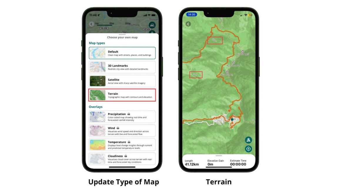
You can now plan routes more efficiently, avoid challenging sections, or select trails that match your endurance level.
This feature is especially useful for trekkers, mountain climbers, and trail runners, where every meter of elevation matters.
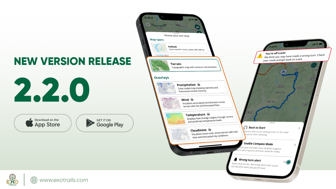
Map Overlays – Stay Prepared for Any Condition
No need to switch between apps to check the weather anymore.
With ExoTrails 2.2.0, you can view dynamic weather overlays, including precipitation, wind, temperature, and cloudiness directly on your map.
No more rushing through the final kilometers in the dark or setting camp too early. With real-time daylight insights, you’ll always stay in sync with nature’s rhythm, knowing when to witness the best dawn or sunset, making every moment outdoors safer and more enjoyable.
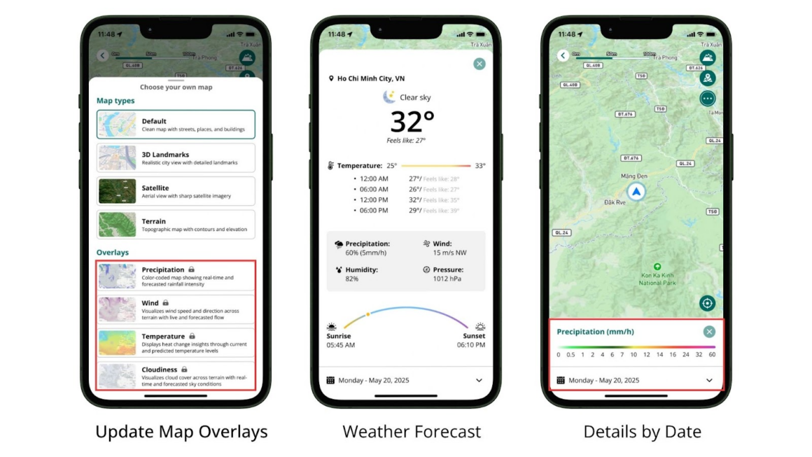
Real-time forecasts allow you to anticipate changing conditions and adapt your route on the go, keeping every journey safe and seamless.
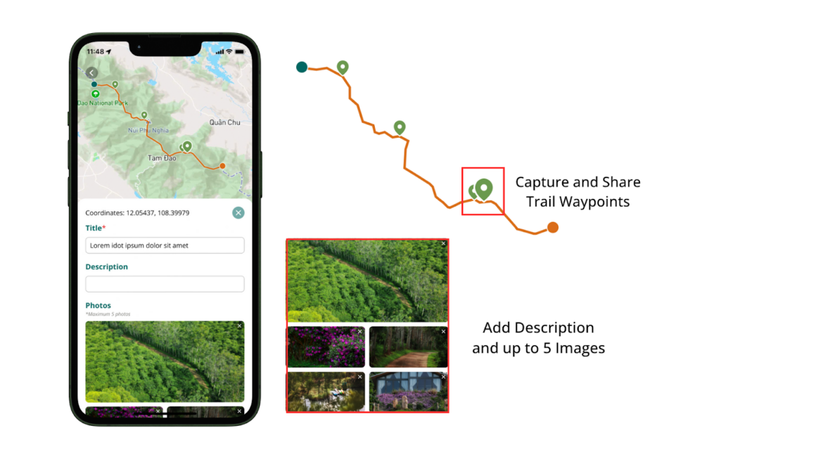
Waypoints – Capture Every Moment on the Map
For the first time ever, ExoTrails 2.2.0 lets you create Waypoints while recording your route.
With Waypoints, you can:
- Mark exact locations with live GPS coordinates and photos.
- Capture and personalize your route, turning every stop into a story worth remembering.
- Share your route and relive every step of your adventure anytime.
Waypoints transform your map from a simple path into a living memory — where every moment is marked, and every journey becomes truly yours.
Waypoints are perfect for:
- Outdoor enthusiasts who love sharing their adventures with friends and communities
- Trekking groups who want to compile and revisit the best moments from their trips
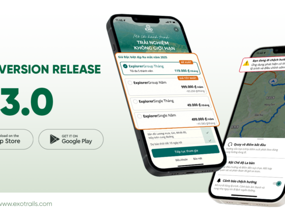
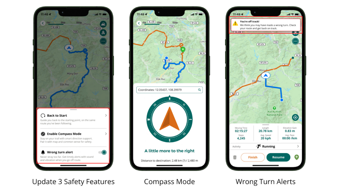
Smarter Navigation Tools – Stay on Track, Always
The upgraded navigation suite in ExoTrails 2.2.0 helps you move with confidence, no matter where your path leads.
When using available or preloaded trails, ExoTrails provides advanced navigation support to keep your journey safe and precise:
- Wrong Turn Alerts: Receive instant sound and vibration notifications if you deviate from your planned route.
- Back to Start: Easily return to your starting point by following the same route you took.
These tools work seamlessly alongside Compass Mode, which helps you navigate freely toward any chosen destination, perfect for open exploration or off-trail adventures.
Together, all navigation features, including Wrong Turn Alerts, Back to Start, and Compass Mode, remain available offline, so you can always find your way even without a network connection.
Disclaimer:
- Remember to download the map and route data before your journey to ensure full offline functionality.
- Wrong Turn Alerts and Back to Start work best when navigating available or preloaded trails.
- While ExoTrails provides real-time guidance and notifications, always combine these tools with your own awareness and navigation skills.
- ExoTrails is not responsible for route changes, environmental hazards, or user safety during outdoor activities.
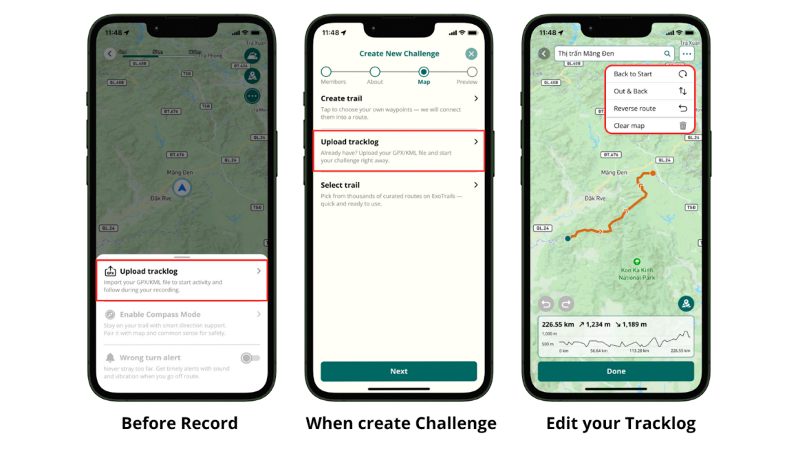
Tracklog Upload – Your Route, Your Way
With ExoTrails 2.2.0, you can upload, edit, and navigate using your own Tracklog files (GPX and KML).
You can upload your Tracklog:
- Before starting a record, if you want to follow a preloaded route.
- When creating a TrackMate Challenge, to plan a shared route for your group.
Whether it’s a path you’ve mapped yourself or one created by your group leader, ExoTrails helps you visualize and navigate it in just a few taps.
Disclaimer:
Routes uploaded via Tracklog are created and managed by users.
ExoTrails does not guarantee the safety, accuracy, or on-ground conditions of any route — whether uploaded by you or by others.
Please assess the terrain, verify conditions, and ensure you’re well-prepared with suitable gear and skills before setting off.
Optimized Your Experience – Smoother, Faster, More Reliable
Alongside new features, ExoTrails 2.2.0 brings a host of performance improvements:
- Faster interface response
- More precise GPS tracking
- Fewer interruptions or bugs during activity recording
This isn’t just a new version, it’s a refined, well-tuned experience that feels effortless from start to finish.
Update ExoTrails 2.2.0 Now To Discover the Difference
ExoTrails 2.2.0 is a testament to our commitment: to keep listening, improving, and building the most comprehensive outdoor companion for the nature-loving community in Vietnam and beyond.
Right now, all the new features in ExoTrails 2.2.0 are fully open for everyone to experience. But soon, as ExoTrails continues to grow, some premium functions will become part of our upcoming subscription plans, offering even more exclusive tools for dedicated adventurers.
Update now on App Store or Google Play to enjoy the complete power of ExoTrails while it’s still free and be one of the first to master the journey before everyone else.
Download/Update the App here.
View Version History here!
Klook.com