
Table of Contents Show
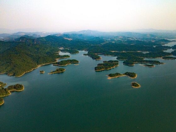
Chư Mom Ray National Park is one of Vietnam’s most important and distinctive protected areas. Beyond its vast tracts of primary forest, it is the only national park in Vietnam that borders both Laos and Cambodia, forming a rare transboundary conservation landscape in Southeast Asia. Thanks to its exceptional ecological value, Chư Mom Ray was recognized as an ASEAN Heritage Park more than 15 years ago.
If you are looking for a truly immersive nature journey, where forests remain forests and humans are merely temporary visitors, Chư Mom Ray is not an easy destination, but it is absolutely worth the effort.
Overview of Chư Mom Ray National Park
- Location: Sa Thầy District and Ngọc Hồi District, Kon Tum Province
- Special position: The Indochina Tri-point area, bordering Laos to the northwest and Cambodia to the west
- Total area: Approximately 56,000 hectares (including strictly protected forest, production forest, and buffer zones)
- Average elevation: 700–1,400 meters
- Highest peak: Mount Chư Mom Ray, approximately 1,773 meters
Chư Mom Ray National Park was established based on the former Chư Mom Ray Nature Reserve. It lies adjacent to Virachey National Park in Cambodia and the Dong Amphon Protected Area in Laos, together forming a continuous forest complex of nearly 700,000 hectares. This positioning gives Chư Mom Ray a critical role in regional biodiversity conservation, not only for Vietnam but for the entire Indochinese peninsula.
Best Time to Visit Chu Mom Ray National Park
- Dry season (November–April): Stable weather, minimal rainfall, ideal for multi-day trekking and forest camping.
- Rainy season (May–October): Lush green forests, flowing streams and waterfalls, stunning scenery, but slippery trails that require experience and careful preparation.
For first-time trekkers in the Central Highlands, the dry season is generally the safer and more accessible option.
How to Get to Chu Mom Ray National Park
Chư Mom Ray National Park is located about 30 km northwest of Kon Tum City. From Kon Tum, visitors can travel by motorbike or car via Sa Thầy or Ngọc Hồi districts.
Location and details about Chu Mom Ray National Park on ExoTrails app.
- Motorbike: Ideal for adventure seekers, offering flexibility for photo stops and closer contact with the landscape.
- Car: Suitable for groups or travelers combining multiple nearby attractions.
Along the way, you can visit notable sites such as Yaly Waterfall, the Ho Chi Minh Trail, and the Bờ Y International Border Gate. The route is scenic, with shaded roads and the cool, fresh air typical of the Central Highlands.
Ecosystems and Biodiversity of Chu Mom Ray National Park
Flora
Chư Mom Ray is considered one of Vietnam’s richest national parks in terms of plant diversity. Current records list approximately 1,534 plant species, including 113 rare and endangered species.
The flora includes dipterocarp species, orchids, gymnosperms, and valuable timber trees such as rosewood, padauk, kim giao, and bamboo pine. Diverse forest types, ranging from evergreen broadleaf forests and semi-deciduous forests to bamboo-dominated areas, create a rare multi-layered ecological structure.
Fauna
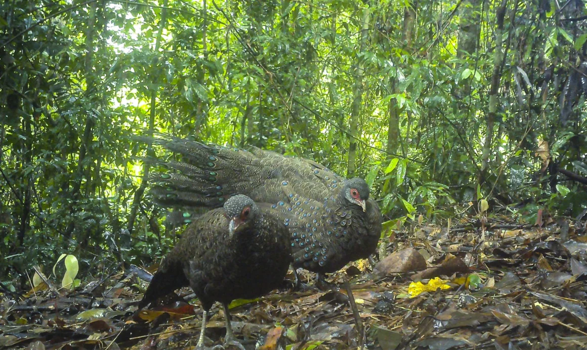
The park is home to over 718 recorded animal species, including mammals, birds, reptiles, amphibians, freshwater fish, and insects.
Notable endangered species listed in Vietnam’s Red Data Book and international conservation lists include the gaur, Truong Son muntjac, red-shanked douc langur, Asian elephant, Asiatic black bear, Indochinese tiger, clouded leopard, great hornbill, green peafowl, and crested serpent eagle. Birds form the most diverse group, with more than 270 species, making Chư Mom Ray especially appealing to wildlife enthusiasts and birdwatchers.

Key Experiences in Chu Mom Ray National Park
Trekking Through Primary Forest
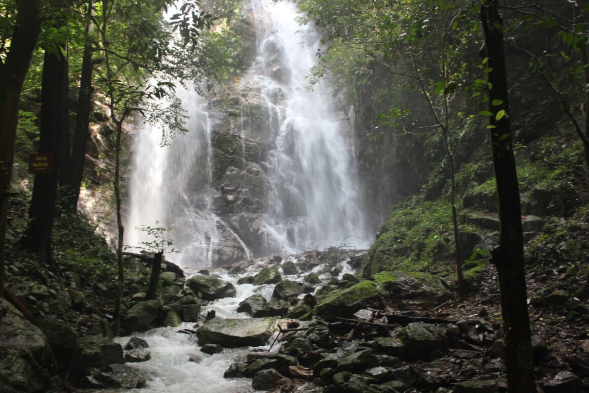
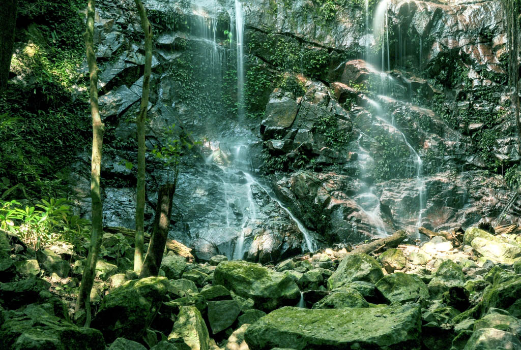
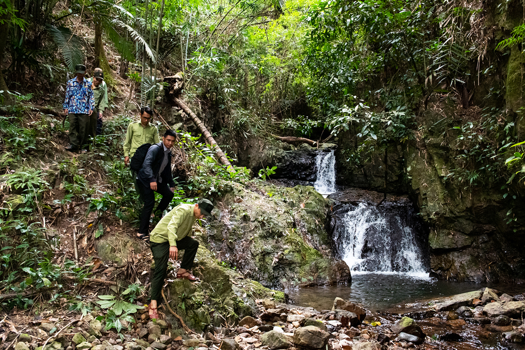
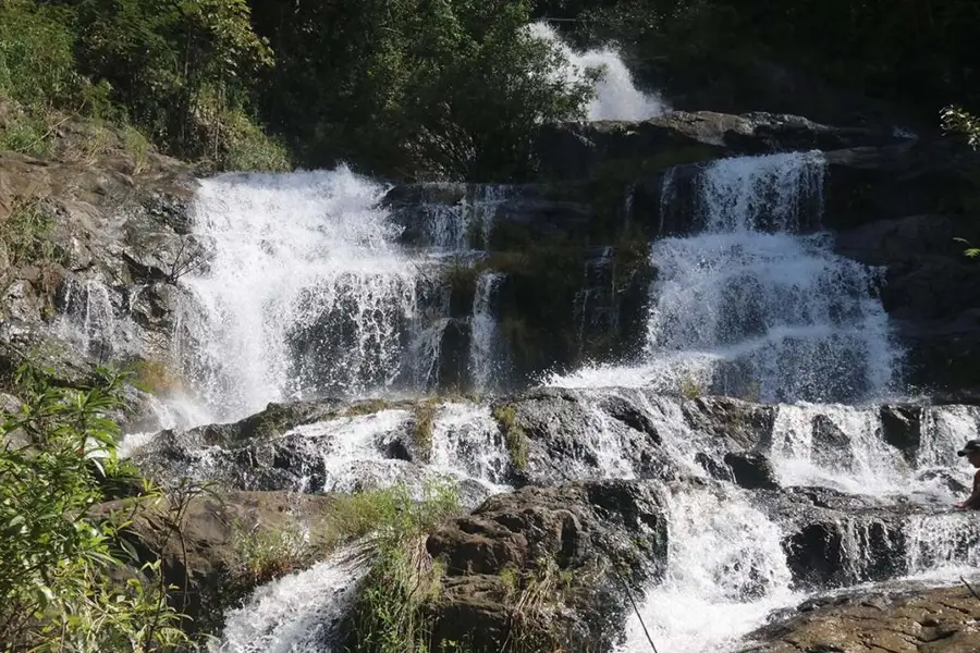
Trekking routes at Chư Mom Ray take you deep into ancient forests, far from human settlements and modern life. Challenging terrain, dense vegetation, and steep streams make the journey demanding but deeply rewarding. Natural highlights such as Monkey Waterfall, Dak Xot Stream, and Dak Koi Waterfall await exploration within the park.
Dak Koi Waterfall Trekking route is available on ExoTrails app.
Summiting Mount Chư Mom Ray
The summit trek typically takes 2–3 days and requires good physical fitness, solid forest trekking skills, and the accompaniment of a local guide. From the top, trekkers are rewarded with sweeping views of the Central Highlands’ border mountain ranges.
Exploring Local Cultures
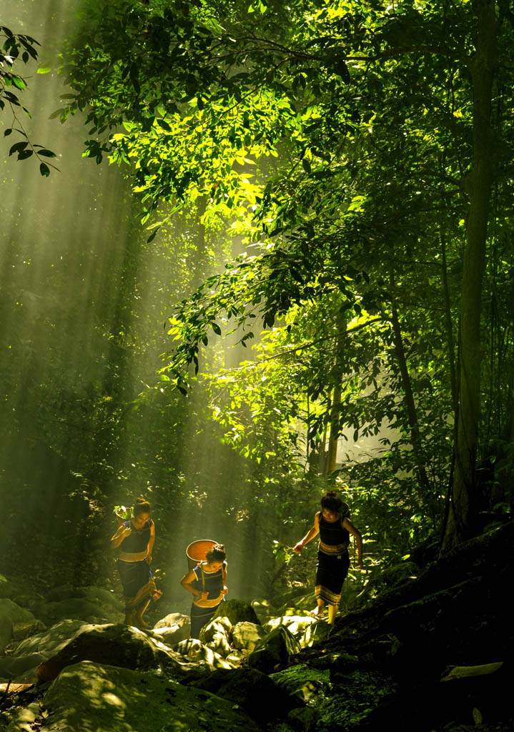
The buffer zone around the park is home to ethnic communities such as the Gia Rai and Rơ Măm. Combining trekking with cultural experiences, including staying in traditional communal houses, adds depth and meaning to the journey.
Nearby Natural and Historical Sites
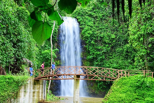
Beyond the primary forest, visitors can explore bamboo forests, Đắk Ke Waterfall, and significant historical landmarks such as the Ho Chi Minh Trail, H67 Base, and Phoenix Airfield, all of which bear witness to the region’s wartime history.
Preparation and Important Notes
- Permits: Entry requires prior registration and approval from the National Park Management Board.
- Local guides: Mandatory for deep and multi-day trekking routes.
- Equipment: Non-slip trekking shoes, rain gear, insect repellent, waterproof bags, and basic first-aid supplies.
- Responsible travel: Do not litter, avoid disturbing wildlife and ecosystems, and respect local cultures and communities.
Discover Chư Mom Ray with ExoTrails
On ExoTrails, you can explore trekking routes, points of interest, and real-world experiences shared by the outdoor community around Kon Tum and the Central Highlands. Reviewing trail details, difficulty levels, and conditions in advance will help ensure a safer and more fulfilling adventure.
Klook.com