
Table of Contents Show
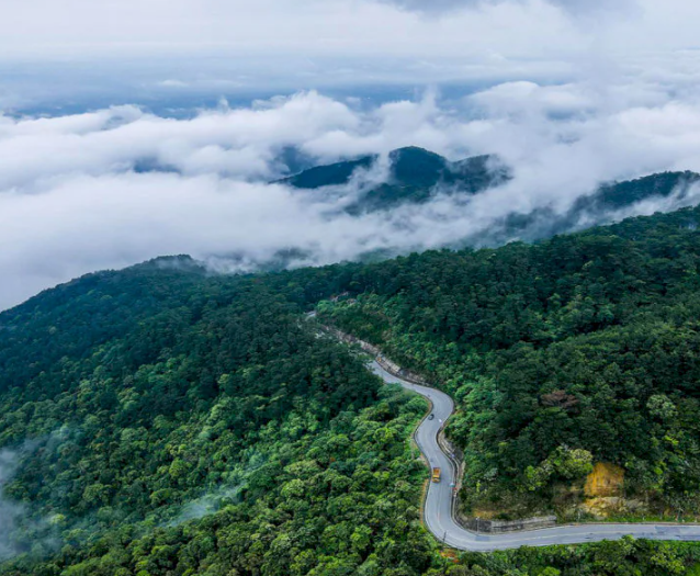
Tam Dao National Park is one of Northern Vietnam’s most attractive destinations for trekking and eco-tourism. With its cool climate year-round, rich tropical rainforest ecosystem, and a diverse network of hiking trails, pilgrimage routes, and camping areas, Tam Dao is an ideal escape for those looking to step away from the city and reconnect with nature.
On the ExoTrails app, you can easily discover curated trekking routes, sightseeing trails, and key destinations within Tam Dao National Park, complete with detailed tracklogs and safety alerts. This guide will help you plan a well-prepared and rewarding journey before you set out.
Tam Dao Town – The Gateway to Tam Dao National Park
Find detailed information about Tam Dao Town on ExoTrails here.
Located at an elevation of nearly 1,000 meters above sea level and approximately 80 km from Hanoi, Tam Dao Town is often referred to as “the Da Lat of Northern Vietnam.” The area is known for:
- A cool, temperate climate throughout the year
- Mist-covered mountains, forests, and valleys
- European-style architecture dating back to the French colonial period
Tam Dao Town serves as the primary starting point for accessing trekking routes and sightseeing trails within Tam Dao National Park, especially those that have been mapped and updated on ExoTrails.
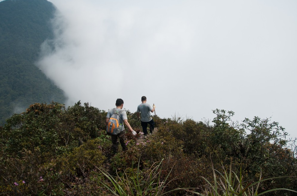
Thach Ban Mountain Trek – One of Tam Dao’s Most Challenging Wilderness Trails
Thach Ban Mountain, located within Tam Dao National Park, is one of the most notable old-growth forest trekking routes in the area. The trail has been documented and shared by the ExoTrails community and offers an immersive experience in pristine subtropical rainforest.
The route spans approximately 16.35 km, cutting through dense jungle, bamboo forests, rocky slopes, dry streambeds, and moss-covered hillsides. This constantly changing terrain delivers a raw and physically demanding adventure.
Find detailed trail information and navigation for the Thach Ban Mountain trek on ExoTrails here.
The estimated trekking time ranges from 9 to 11 hours, making the journey most suitable as a 2-day, 1-night itinerary, often combined with overnight camping and early-morning cloud hunting. The best seasons for trekking are March–May and September–November, when the weather is cooler, rainfall is lower, and visibility is clearer. Hikers should carry sufficient water, high-energy food, and proper trekking gear, as there are no reliable water refill points along the trail.
Due to steep, slippery terrain and frequent fog, Thach Ban Mountain is not recommended for first-time trekkers. ExoTrails strongly advises downloading offline trail maps in advance, starting early in the day, and trekking with a local guide to ensure safety.
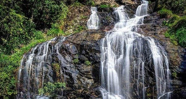
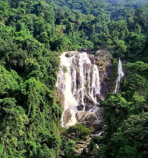
Silver Waterfall – Tay Thien: A Popular Trekking Rest Stop in Tam Dao
Silver Waterfall (Thac Bac – Tay Thien) is located within the Tay Thien Scenic and Cultural Complex in Dai Dinh Commune, Tam Dao District, Vinh Phuc Province. It is a well-known stop along the Tay Thien pilgrimage trekking route, blending the natural beauty of Tam Dao National Park with a serene spiritual atmosphere.
View detailed information about Silver Waterfall on ExoTrails here.
Key Features of Silver Waterfall:
- Situated along the hiking route from the mountain base to Tay Thien Pagoda
- Multi-tiered waterfall with strong, clear flows during the rainy season
- Approximately 300 stone steps leading down to the waterfall
- Surrounded by lush forest and fresh mountain air
Reference Fees:
- Waterfall access: Free
- Tay Thien cable car: 200,000 – 220,000 VND (round trip)
Trekking Notes:
- Wear trekking shoes or footwear with good grip
- Bring drinking water and light snacks
- Avoid visiting during heavy rain due to slippery steps
- Do not litter in streams or waterfall areas
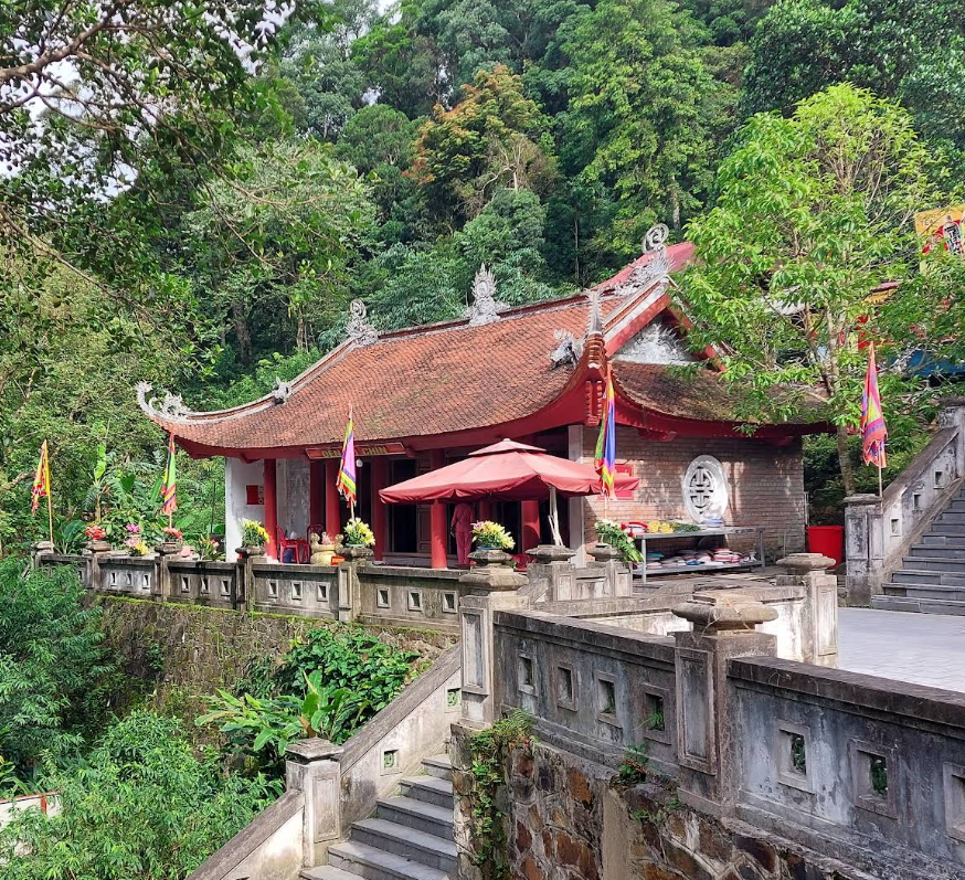
Tay Thien Scenic Route – Temples & Silver Waterfall Trail
This is one of the most prominent sightseeing routes within Tam Dao National Park and is fully available on ExoTrails with detailed tracklogs. Simply open the app and follow the route. You can even use Offline Mode for navigation.
View the full Tay Thien Scenic Route – Temples & Silver Waterfall on ExoTrails here.
Route Highlights:
- Starts at the Tay Thien triple gate
- Passes Den Cau and Den Co temples
- Ends at Den Thuong, dedicated to National Mother Lang Thi Tieu
- Combines temple visits with forest and waterfall scenery
Cultural & Historical Significance:
- Vietnam’s most important center for National Mother worship
- Closely associated with the Tay Thien Festival (15–17 of the second lunar month)
- A blend of ancient temples and surrounding mountain landscapes
Best Time to Visit:
- March–May & September–November: cool weather, low rainfall
- Second lunar month: festival season (very crowded)
- Winter: misty, atmospheric scenery
Tickets & Internal Transport:
- Electric shuttle: 20,000 – 40,000 VND per ride
- Cable car: 150,000 – 240,000 VND
- Entrance fee: Free
Safety Notice: Tracklogs on ExoTrails are for reference only. Trail conditions may change due to weather or maintenance work. Always check with Tam Dao National Park authorities or local tour operators for the latest updates.
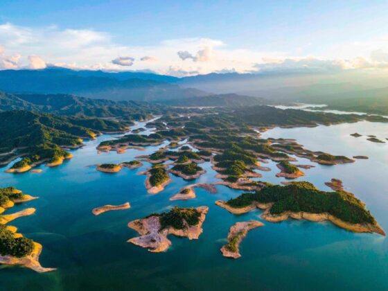
Xa Huong Lake – A Quiet Trekking & Camping Spot Near Tam Dao
Xa Huong Lake is a man-made reservoir nestled in a forested valley, ideal for light trekking, picnics, and weekend camping. It is favored by the ExoTrails community for its peaceful atmosphere and relatively untouched landscape.
Find navigation and details for Xa Huong Lake on ExoTrails here.
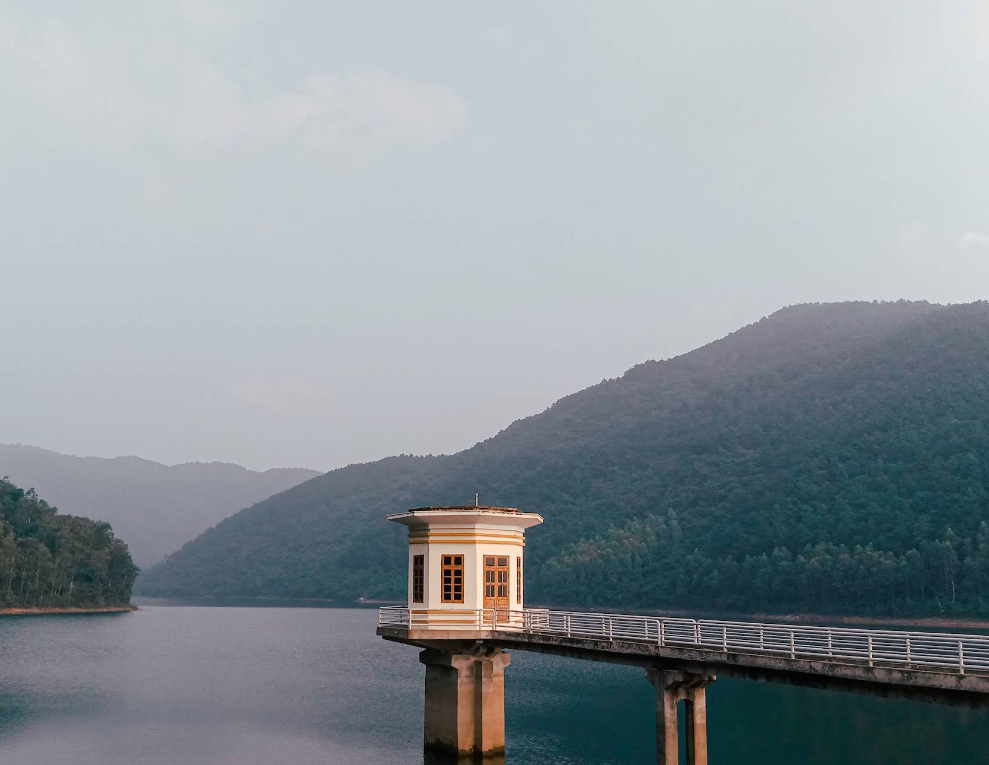
Key Features:
- Wide lake surface with multiple branches
- Clear water and cool, fresh air
- Flat lakeside areas suitable for camping
- A dam viewpoint offering panoramic views
Reference Costs:
- Motorbike parking: ~10,000 VND
- Boat transfer: ~100,000 VND per person
- Private boat rental: from 500,000 VND
Visitor Notes:
- Very limited services in the area
- Bring sufficient food and drinking water
- Do not drink untreated stream water
- Carry out all trash and leave no trace
Getting to Tam Dao National Park: Transportation & Estimated Costs
| Transport | Route | Estimated Cost |
|---|---|---|
| Coach | Hanoi → Tam Dao | 150,000 – 200,000 VND/person (one way) |
| Car | Hanoi → Noi Bai → QL2 → QL2B | 1,200,000 – 1,800,000 VND/day |
| Motorbike | Hanoi → QL2 → Tam Dao Pass | 75,000 – 100,000 VND (fuel) |
| Bus | Route 58 → Route 01 → motorbike taxi/taxi | 110,000 – 290,000 VND |
| Taxi | Direct from Hanoi | 700,000 – 950,000 VND (one way) |
From Silver Waterfall Tay Thien and the Tay Thien Scenic Route to Xa Huong Lake, Tam Dao National Park offers a wide range of trekking routes and nature experiences suitable for different skill levels.
Open the ExoTrails app, search for Tam Dao National Park, download your tracklogs, and begin your journey with confidence using the EXPLORER feature package for a safer and more enjoyable outdoor experience.
Klook.com